Take a Hike, Get a Medal
The Great Western Trail is a unique corridor of braided and paralleling trails for both motorized and non-motorized users. The trail system traverses 4,455 miles through Arizona, Utah, Idaho, Wyoming, and Montana. It incorporates stunning desert and canyon landscapes, plateaus, woodlands, dense forests and alpine meadows. It links 18 National Forests, Tribal, State and BLM administered lands and encompasses the most diverse vegetation, topography and wildlife in the western United States.
The Great Western Trail encompasses many of the popular trails throughout the five states. It is unusual in the sense that it provides "something somewhere for everyone." Some segments are non-motorized, some are shared use, while other portions are developed for motorized use.
In 1996, the Great Western Trail was designated Utah's Centennial Trail as part of the Statehood Centennial celebration. In 2000, the GWT was designated one of 16 National Millennium Trails by the White House and the Department of Transportation. The Great Western Trail is currently under study by the U.S. Congress to become part of the National Trails System.
Trail in the Grand Staircase-Escalante National Monument
Click here to Download the Trail Map
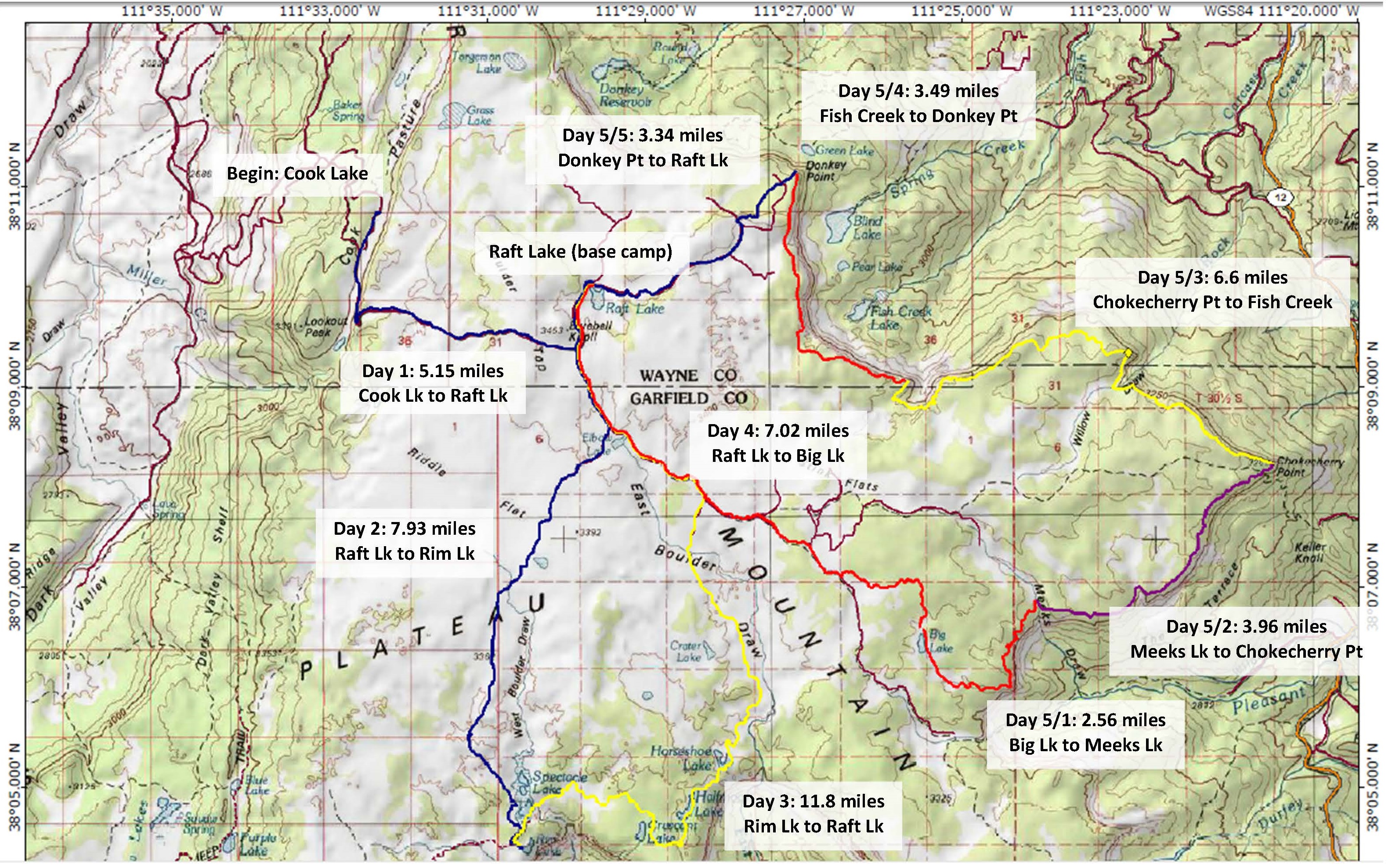
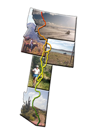
This trail map is near Lookout Peak and Bluedell Knoll in central Utah. This trail suggestion is also near Capital Reef National Park, which would also serve as an alternative for completion of this medal. Special thanks to Troop 746 and Scoutmaster Gary for allowing us to use this information.
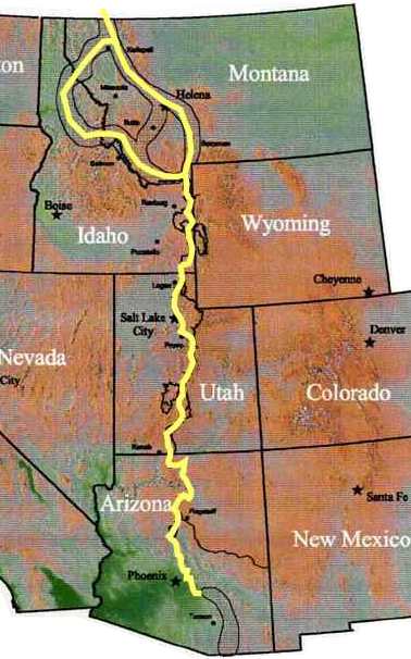
The General Route of the Trail
The Great Western Trail will eventually stretch from Canada to Mexico, going through Montana, Idaho, Wyoming, Utah, and Arizona. In Utah, the trail is fairly well developed and marked throughout a number of National Forests, but it is not yet linked from the Arizona border to the Dixie National Forest.
The majority of the Great Western Trail is open to multiple use, so no matter if you are on a mountain bike, a horse, an ATV or your own two feet, you can use it to explore the natural wonders of the state.
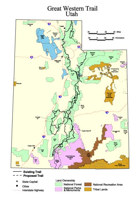
Great Western Trail - Utah
Utah Dixie National Forest: About 125 miles, from the southwestern corner of the forest, south of Bryce Canyon National Park, northeast through the Escalante Mountains, skirting the southern edge of the Aquarius Plateau, and over the Boulder Mountains into the Fishlake National Forest.
Fishlake National Forest: From Torrey the trail goes about 75 miles north through the forest to the Border of the Manti-La Sal National Forest. At several points it crossed the Paiute ATV trail, so those who prefer motorized vehicles can ride more or less parallel to those who prefer bikes, feet, and horses.
In the Manti-La Sal National Forest, the Great Western Trail turns into the Adventure Highway and runs concurrently with Skyline Drive north to the Uinta National Forest.
In Uinta National Forest: From the southern border, the trail is 65 miles long, skirting Lone Peak & Timpanogos Wilderness areas, then along Strawberry Ridge to Spanish Fork Canyon.
Wasatch-Cache: From Albion Basin, the trail skirts the eastern face of the Wasatch Front (that is, the back of the front), occasionally crossing onto private lands. North of Ogden the trail joins UT-165, goes east on UT-101, then north into the forest again. It crosses the Idaho border just north of Beaver Mountain. The distance is roughly 150 miles.
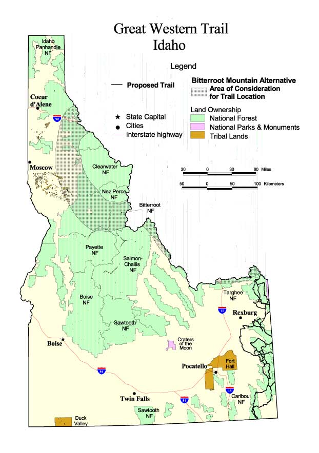
Detailed Maps
"Rollin, Rollin, Rollin, Keep those doggies rollin"
| A. | Camp 2 days and 1 night along or in the vicinity of the trail. | ||||||||
| B. |
Travel the Trail Using One or More of the Choices Below
|
||||||||
| C. | Study the History of the Trail and Complete the Trail Quiz | ||||||||
| D. | Visit an Interpretive Center or Historic Marker |