Take a Hike, Get a Medal
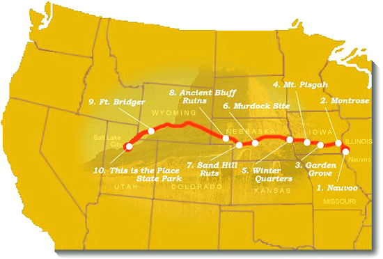
Led by Brigham Young, over 70,000 Mormons traveled along the Mormon Trail from 1846 to 1869 to escape religious persecution. Beginning in Nauvoo, Illinois, the Mormon Pioneer Trail crossed Iowa, connected with the Great Platte River Road at the Missouri River, and ended near the Great Salt Lake in Utah, nearly 1,300 miles later. An integral part of Mormon history, tens of thousands of Mormon emigrants passed through five states during this mass migration and resulted in a new home in the Great Basin. This area later became the State of Deseret, then the Utah Territory, and finally the State of Utah.
Area Overview
For folks along the Wasatch Front the most commonly traveled portion of the Mormon Trail is Big Mountain Pass down to Little Dell Reservoir. The Pony Express, California, and Mormon Trails can be traveled jointly from the top of Echo Canyon, down around Echo Reservoir, on to State Road 65, up and over Big Mountain and down into Emigration Canyon, ending at This is the Place Monument. There are several sections that you can travel, depend on the age of your scouts, skill and knowledge of the leaders, and amount of time that you have available.
Route Suggestion
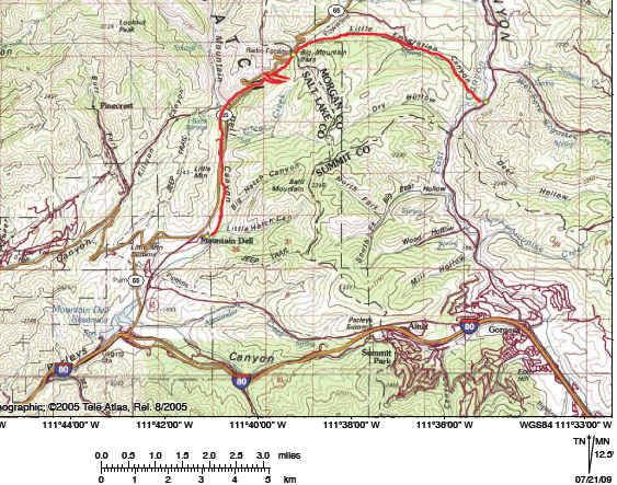
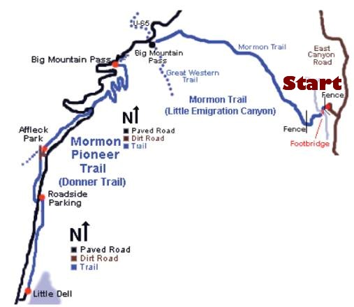
Mormon Trail (Little Emigration Canyon to Big Mountain Pass to Little Dell Reservoir) Length: 10.1 miles one way Getting There: Take I-80 eastbound from Salt Lake. Just after Parley’s Summit, take the Jeremy Ranch exit and turn north (left) under the freeway. Turn left at the fi rst stop sign, then take the next right (Jeremy Ranch Drive). Continue until the road turns sharply around to the right, where you’ll see the dirt East Canyon Road branching off to the left. Drive 4.9 miles up the dirt road until you see the parking area for the trail (and picnic tables and a bathroom) on your left. GPS N 40° 48.944’ W 111° 35.080’. (Some bikers have a shuttle drop them off at the summit on U-65, then meet them in Jeremy Ranch.)
Trip Overview
Hike: 10 Miles along the Mormon Trail Begin at the Historic Mormon Flat Pioneer Camp on the map. This portion of the trail is nice for several reasons, 1) it is very close to the authentic trail, 2) you will be traveling the same direction, experiencing the landscape in the same way that the pioneers experienced it traveling to Utah, 3) it is relatively close to Salt Lake City, and 4) the trail is good workout but not too strenuous and 5) it is extremely well marked with trail markers and mileage every mile. The trail starts at the pioneer camp site just off the East Canyon road, GPS N 40° 48.944’ W 111° 35.080’. (Cross the narrow footbridge to the other side of East Canyon Creek.) Initial altitude is 6000 feet. After meandering, the trail climbs gradually up the side of a small creek. This portion of the trail follows the path of the Donner Party, Pony Express, and Mormon pioneers from East Canyon up to Big Mountain Pass overlooking Emigration Canyon. The trail is 4.6 miles long. Vertical rise is 1400 feet, to an altitude of 7400 feet at the pass. At the top of the pass, it links to the Mormon Pioneer Trail as well as the Great Western Trail This portion of the trail ends at highway U-65 at the ridge line. There’s a historical marker here. GPS N 40° 49.687’ W 111° 39.244’. The Great Western Trail can be seen heading south from the historical marker, and north across the road. Heading downhill across the parking area, the Mormon Pioneer Trail (Donner Trail) heads down towards Parley’s Canyon. NOTE: dogs are NOT allowed west of the summit! In commemoration of the early pioneers, a 4-foot wide Pioneer Historic Trail between Big Mountain and Little Dell Reservoir has been constructed. From Big Mountain Pass the trail descends 5.5 miles to Little Dell Reservoir, Standing atop Big Mountain summit at 7,420 feet above sea level, between Morgan and Salt Lake Counties, Utah, looking west is a spectacular view of the Wasatch Mountains. Big Mountain has special historic significance. It is where the early pioneers saw their first glimpse of the Salt Lake valley. On July 23, 1847 Brigham Young first viewed the Salt Lake valley from this viewpoint. His account reads, “I ascended and crossed over the Big Mountain, when on its summit I directed Elder Woodruff, who kindly tendered me the use of his carriage, to turn the same half way round, so that I could have a view of a portion of Salt Lake valley, and I felt that there the saints would find protection and safety. We descended and encamped at the foot of the Little Mountain.”
Camp at Affleck Park
Camp Details
Affleck Park has 21 camping areas and is now a reservations only facility! Go to to select a site and make a reservation. Affleck Park is located in Dell Canyon around mile marker 6 on State Highway 65. The park is surrounded by aspen trees and beautiful canyon scenery. The Mormon Pioneer Trail goes right through the park. Affleck Park is within the Parley’s Canyon Protected Watershed and falls under the guidelines and restrictions of the Salt Lake City Chapter 17.04 Watershed Ordinance.
Camp Reservation Number: (801) 483-6705
Fee: $ 3.00/Campsite
Extra Vehicles at Campsite: $ 5.00 each
Interpretive Center
Visit the This is the Place Heritage Park
Phone Number: (801) 582-1847
Address: 2601 Sunnyside Ave Salt Lake City, UT 84108-1453
Hours: 9am-5pm Sunday-Saturday
Admission Prices
Adults $8.00
Children (3-11) $6.00
Admission includes any three (3) take-home craft, pony ride, mini-train ride. Additional activities $1 per craft or ride.
Other Activities
Mountain Biking, Backpacking, Camping, Horseback Riding, Wildlife Viewing, Kayaking or Canoeing in Little Dell Reservoir, Pioneer History, Mormon Handicrafts and Games
BSA Policy Reminders
A. Know and practice the principles of Leave No Trace. B. Have two deep leadership at all times. C. Wear appropriate uniforms for all activities D. File and carry an approved Tour Permit.
The General Route of the Trail
The trail started in Nauvoo, Illinois, traveled across Iowa, connected with the Great Platte River Road at the Missouri River, and ended near the Great Salt Lake in Utah.
First Explored By
The early routes were discovered and used by the early trappers, mountain men and fur traders who were among the first whites to live in the Mountain West.
Dates Used
1846-1869
The Purpose of the Trail
The Mormon Trail was one of the main overland routes to guide early American settlers as they travelled west across the United States. From 1846 to 1869, more than 70,000 members of the Mormon faith traveled along an integral part of the road west, the Mormon Pioneer Trail. The fact of the matter was the the Mormons were not inherently, explorers or pioneers but folks who wished to live out the American promise of their right and freedom to practice the religion of their choice. However, the Quincy Convention of October 1845 passed resolutions demanding that the Latterday Saints withdraw from Nauvoo, Illinois by May 1846. A few days later, the Carthage Convention called for establishment of a militia that would force them out if they failed to meet the May deadline. So, whether they were ready or willing to be explorers, pioneers, or settlers in a new land, they didn't have much of a choice if they want to keep their hides whole.
The Early History of the Trail
The Mormon Trail was first pioneered by the Hudson Bay Company and John Jacob Astor’s fur company. These two companies sent many expeditions to explore and map the western portion of the North American continent during the first part of the 19th century. This allowed for others to continue their work and begin to establish routes to the west.
The Trek of 1847
The longest leg of the journey began at Winter Quarters on April 5, 1847, and ended when Brigham Young entered Valley of the Great Salt Lake. The trip went smoother than the previous year’s journey because the Mormons were better organized, had better provisions, and began the trek when trail conditions were optimal. The lead pioneer party left with 148 people (143 men, 3 women, and 2 young boys), 72 wagons, 93 horses, 66 oxen, 52 mules, 19 cows, 17 dogs, and some chickens. On July 24, 1847. after a long, tough journey, Brigham Young arrived in the Valley of the Great Salt Lake and began the settling of the Intermountain West.
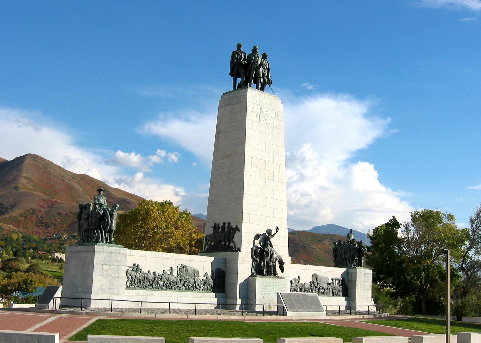
This is the Place Monument
How long was the journey from Nauvoo, Illinois to the Great Salt Lake?
Approximately 1300 miles.
How many emigrants followed the trails to Utah?
More than 70,000 Mormons traveled along an integral part of the road west.
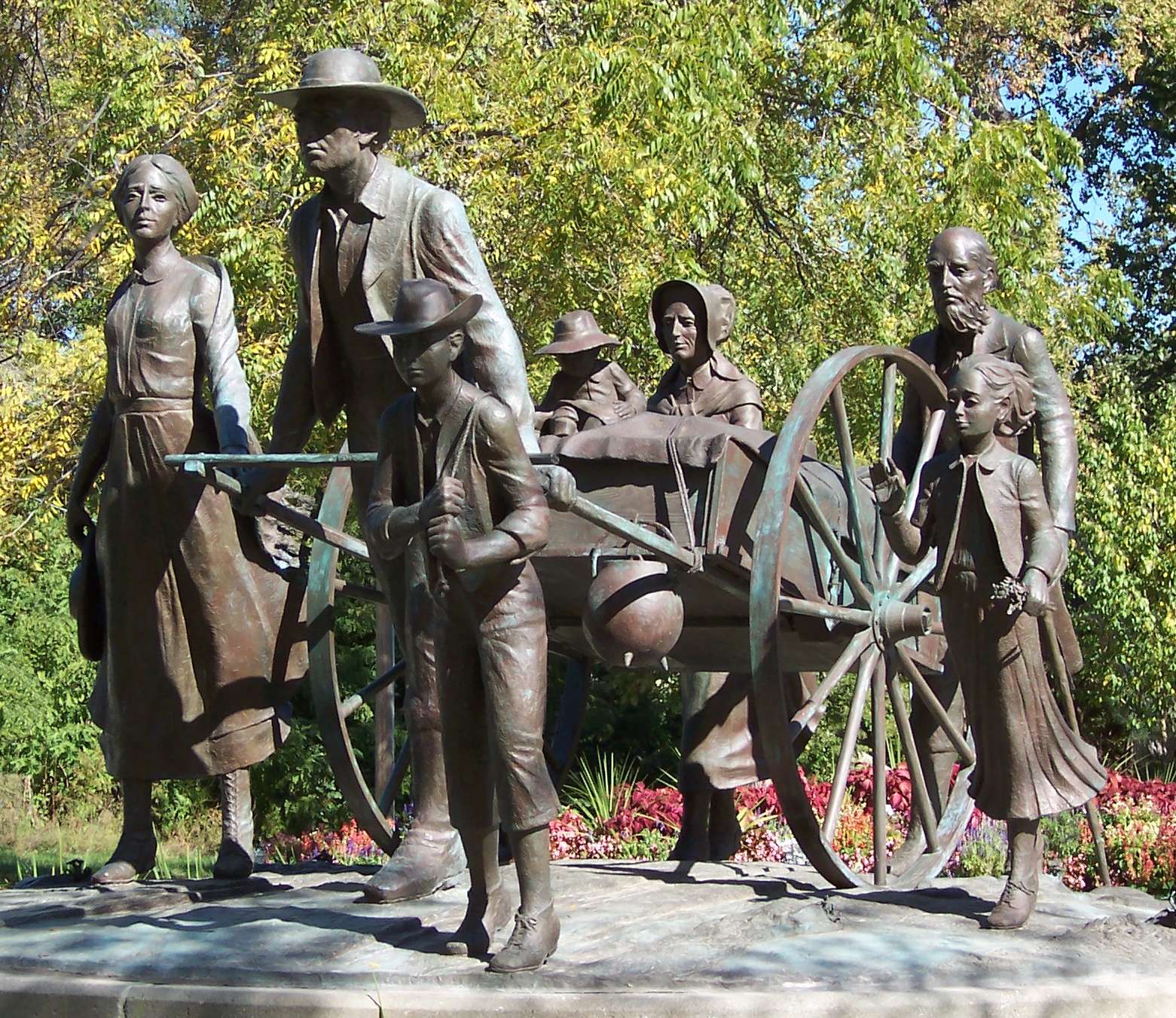
Pioneer Handcart Company
How long did the trek take, on the average?
Subject to considerable variation because of weather, accidents, etc., on the average a wagon train could expect to be “on the road” for 3-4 months.
The “This Is the Place” Monument
The “This Is the Place” Monument is located at the mouth of Emigration Canyon in Salt Lake City, Utah. In 1937 a state commission comprised of representatives of various faiths selected Mahonri M. Young, a grandson of Brigham Young, to design the monument, which derives its name from the words Brigham Young is said to have pronounced in the foothills of Emigration Canyon: “This is the right place. Drive on.”
The monument was dedicated during Utah’s pioneer centennial celebration in 1947. The granite structure stands sixty feet high and eighty-six feet long. It memorializes, in bronze sculptures, the Mormon pioneers as well as the traders, trappers, explorers, and others who were instrumental in the development of the West.
The figures atop the center pedestal are Brigham Young in the center, Heber C. Kimball to the north, and Wilford Woodruff to the south. The three were prominent leaders during the early days of the Mormon Church.
At the base of the center column are Orson Pratt and Erastus Snow, members of a scouting party and the first to enter the valley on 21 July 1847. To the sides are the nine horsemen who made up the exploring party. The wagon of the first pioneer company is depicted in bas-relief sculpture along the west side of the wings, with Brigham Young visible in Woodruff’s carriage at the rear.
Along the east side are high relief sculptures of six men who were significant figures in early regional history: Etienne Provost, Chief Washakie, Peter Skene Ogden, Captain Benjamin Bonneville, Father Jan DeSmet, and John C. Fremont. The Mormon pioneers followed the same route blazed the previous year by the Donner- Reed party, depicted on the east side of the center pedestal.
The figures on the south pedestal depict Spanish explorers who came into the area in 1776. The Dominguez-Escalante expedition came as far north as Utah Valley in an attempt to find a practical overland route to Monterey, California. Their account provided the first written description of the Intermountain region.
In the 1820s trappers and traders came to the American West to capitalize on the market for beaver pelts. These men, represented on the north column, were the first white men to see many of the mountains, rivers, lakes, and valleys of the West. William Ashley of the Rocky Mountain Fur Company is the figure sitting astride the horse.
The Handcarts: 1856 to 1860
A unique feature of the Mormon migration was their use of handcarts. Handcarts, twowheeled carts that were pulled by emigrants, instead of draft animals, were sometimes used as an alternate means of transportation from 1856-1860. They were seen as a faster, easier, and cheaper way to bring European converts to Salt Lake City. Almost 3,000 Mormons, with 653 carts and 50 supply wagons, traveling in 10 different companies, made the trip over the trail to Salt Lake City. While not the first to use handcarts, they were the only group to use them extensively.
The handcarts were modeled after carts used by street sweepers and were made almost entirely of wood. They were generally six to seven feet long, wide enough to span a narrow wagon track, and could be alternately pushed or pulled. The small boxes affixed to the carts were three to four feet long and eight inches (203 mm) high. They could carry about 500 pounds, most of this weight consisting of trail provisions and a few personal possessions.
All but two of the handcart companies completed the journey with few problems. The fourth and fifth companies, known as the Willie and Martin Companies, left Iowa City, Iowa in July 1856. This was very late to begin the trip across the plains. They encountered severe winter weather west of present day Casper, Wyoming, and hundreds died from exposure and famine before rescue parties could reach them. While these incidents were a rarity, they illustrate that an early departure date from the trail head was crucial to a successful journey.
Many emigrant diaries note the sighting of buffalo. Does anyone know just how many bison actually did exist before whites penetrated the American west?
Not exactly! You have your choice of estimates. Francis Haines says there were about 40 million head occupying almost half of the North American Continent. Charles M. Robinson indicates that some estimates run as high as sixty million and E. Adamson Hoebel and Ernest Wallace report estimates of at least 100 million.
Timber was noticeably absent on the Platte-Sweetwater route. Just how effective as fuel were the buffalo chips (droppings) most emigrants used as a substitute?
It took two or three bushels of chips to heat a meal because chips burned so rapidly. [Merrill Mattes, The Great Platte River Road, p. 57.]
Which type of draft animals were most frequently used by over landers?
“John Unruh, Jr. and Merrill Mattes, the two premier scholars of westward migration, are in general agreement that oxen were much preferred, with horses and mules considerably less favored. Unruh is content to make the general observation that more than half of all over landers’ wagons were pulled by oxen, while Mattes cites diary excerpts that suggest a figure closer to two-thirds or three-quarters ... The cost of a yoke of oxen during the last half of the 1840s varied from a low of $25 to a high of $65.” [Robert L. Munkres, “Wagon Train Animals,” Annals of Wyoming, Summer/Fall 1993, p 16.]
Describe a typical pioneer day on the trail
Many Pioneers had a milk cow tied to the tailgate of the wagon. After milking the cow, the milk sat until the cream raised to the top. Each morning, the cream was poured into a churn carried in or on the side of the wagon. As the churn bounced along over the rough trail, the cream turned to butter.
After a few days on the trail, the travelers settled into a well-defined daily routine. Wake before sunup; yoke the oxen, cook the breakfast (usually warm johnnycakes and bacon); and hit the trail. There was an hour break for lunch, and at about 6 p.m., the wagon trains stopped for the night. It is often stated in Pioneer Journals that the wagons were circled to provided a corral for the livestock.
In small trains this may be true, but a wagon train of say one hundred wagons would have at least four-to-six hundred oxen or more, milk cows, and saddle horses. A hundred wagons could not make a circle big enough to hold that many animals, and even if it did, what did the animals eat? The grass in the circle would be tramped down and covered with several inches of manure in a matter of hours. In the vast semi-arid areas of the Mormon Trail, animals would have to eat at least ten-to-twelve hours at night to have enough strength to pull the wagons and produce milk.
The Trail Today
Congress established the Mormon Pioneer National Historic Trail as part of the National Trails System on November 10, 1978. This historic trail commemorates the 1846-47 journey of the Mormon people from Nauvoo, Illinois to the Valley of the Great Salt Lake. The designated corridor is almost 1,300 miles long and is managed as a cooperative effort among private landowners,
Books
Historical Societies Affliated with Trail
Reenactments Near Salt Lake City, Utah
Sites affiliated with the Church of Jesus Christ of Latter-day Saints (Mormons)
National Park Service
Other Federal Agencies
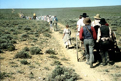
We hiked this trail on Pioneer Day, July 24, to celebrate the arrival of the Mormon Pioneers in the Salt Lake Valley
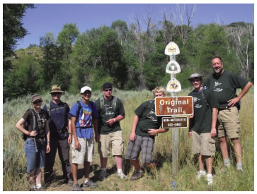
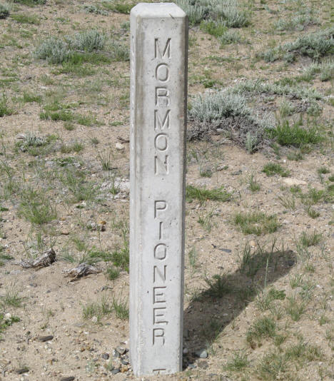
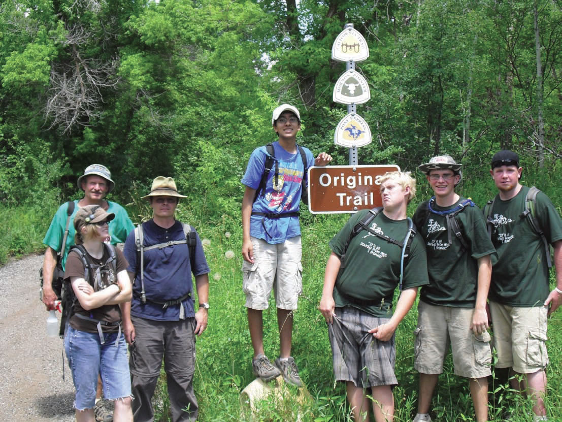
This is the sign at the start of Little Emigration trail near Mormon Flat Campground
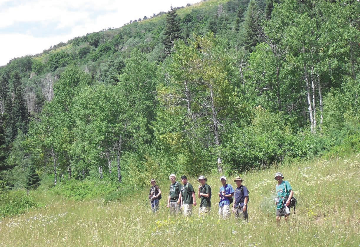
Moderate grades on the trail and tons of wild flowers to enjoy
The trail from big Mountain Pass is all downhill and, if you have great brakes, is a really fun mountain bike ride. This is Big Mountain Pass where you can see the Salt Lake Valley
Signs in Affleck Park letting you know that you have not lost your way
"Hey Thanks Brother Brigham"
| A. | Camp 2 days and 1 night along or in the vicinity of the trail | ||||||||
| B. |
Travel the Trail Using One or More of the Choices Below
|
||||||||
| C. | Study the History of the Trail and Complete the Trail Quiz | ||||||||
| D. | Visit an Interpretive Center or Historic Marker |